1 / 4
Liupian Mountain Hiking
Free Cancellation
Full refund if you arrive 24 hours in advance
Activity Tags
Natural Landscapes
Guide Service
English, Chinese, Cantonese
Product Brief
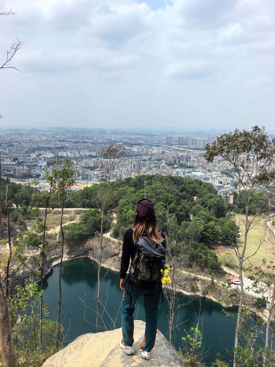
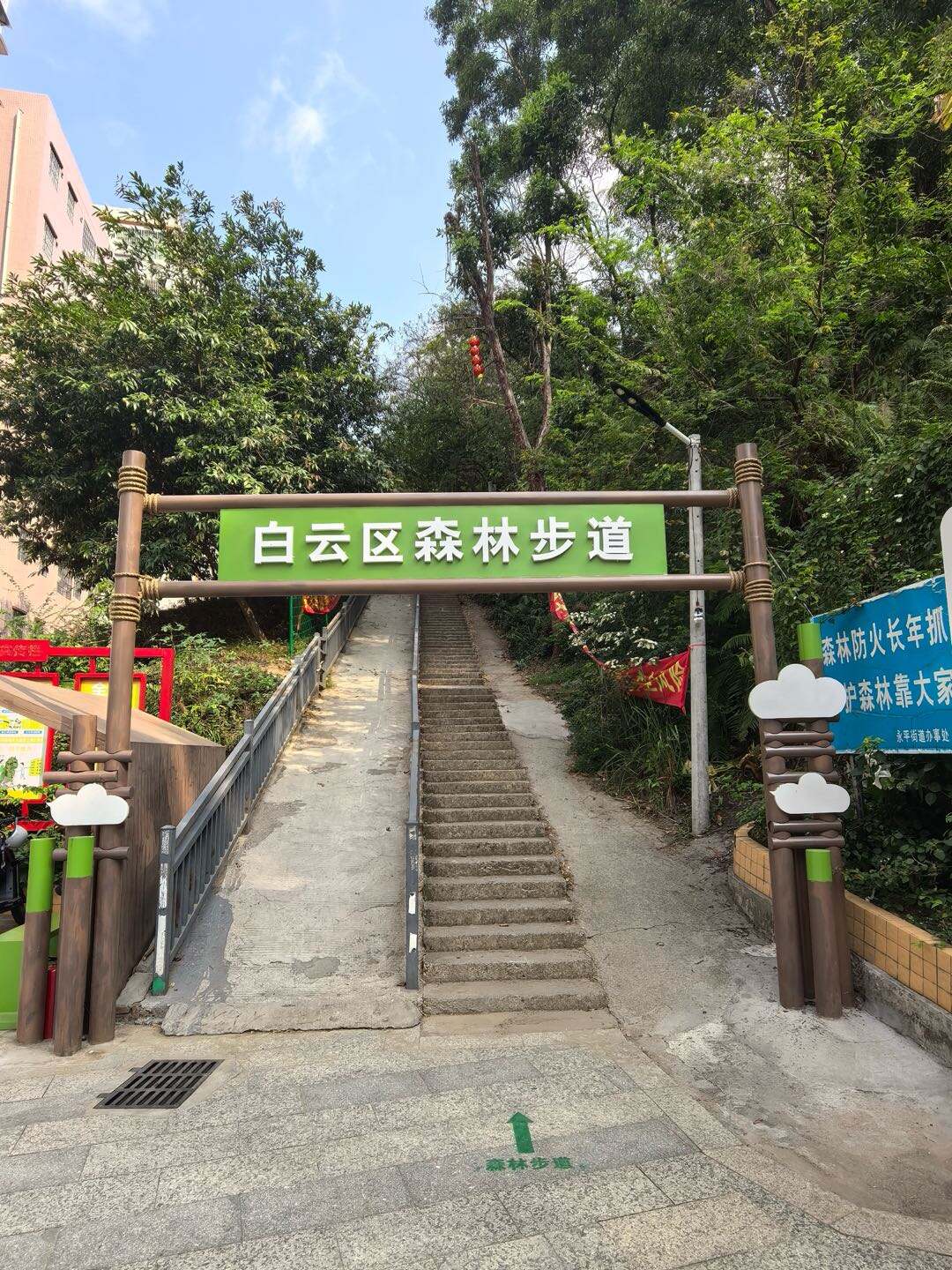
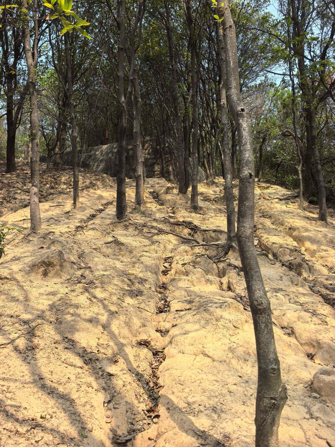
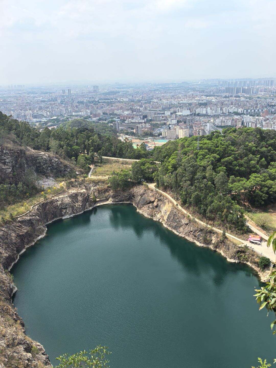
This Liupian Mountain hiking route is about 9–10 kilometers long and normally takes 4–5 hours to complete. It is an entry-level hiking trail within Guangzhou city, mainly consisting of forest paths and stone steps with dense shade and little sun exposure. Along the way, you will pass a wild fitness area, mountain forests, and reservoirs, and finally reaching the summit viewing rock, where you can overlook the popular Tianchi lake “Blue Tears”. The trail offers great scenery, low difficulty, and is perfect for beginners and casual hiking.
Route Overview
Exit B2, Yongtai Station, Metro Line 3→ No.1 Fitness Base → Honglu Reservoir → Tianchi Viewing Platform (Blue Tears) → Tianxin Elong Sports Park
Total distance: About 9 km
Total time: 4–5 hours
Difficulty: Entry-level
Route Overview
Exit B2, Yongtai Station, Metro Line 3→ No.1 Fitness Base → Honglu Reservoir → Tianchi Viewing Platform (Blue Tears) → Tianxin Elong Sports Park
Total distance: About 9 km
Total time: 4–5 hours
Difficulty: Entry-level
Itinerary
1
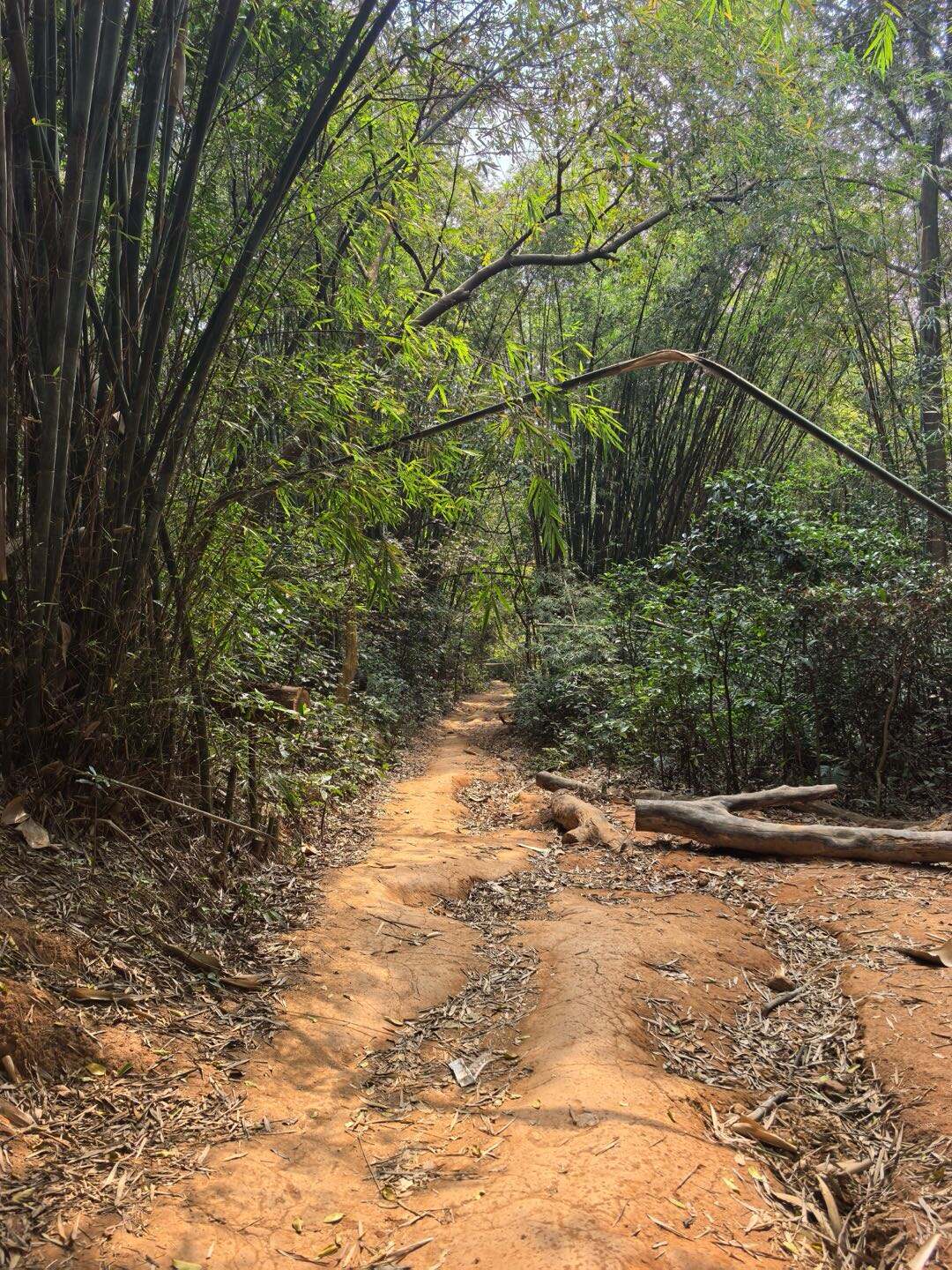
Stage 1: Exit B2, Yongtai Station → No.1 Fitness Base(1km)• Road conditions: Gentle steps and forest trails, with plenty of shade• Scenery: Lush mount
20 minStage 1:
Exit B2, Yongtai Station → No.1 Fitness Base(1km)
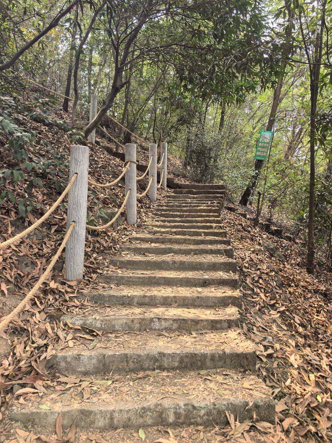
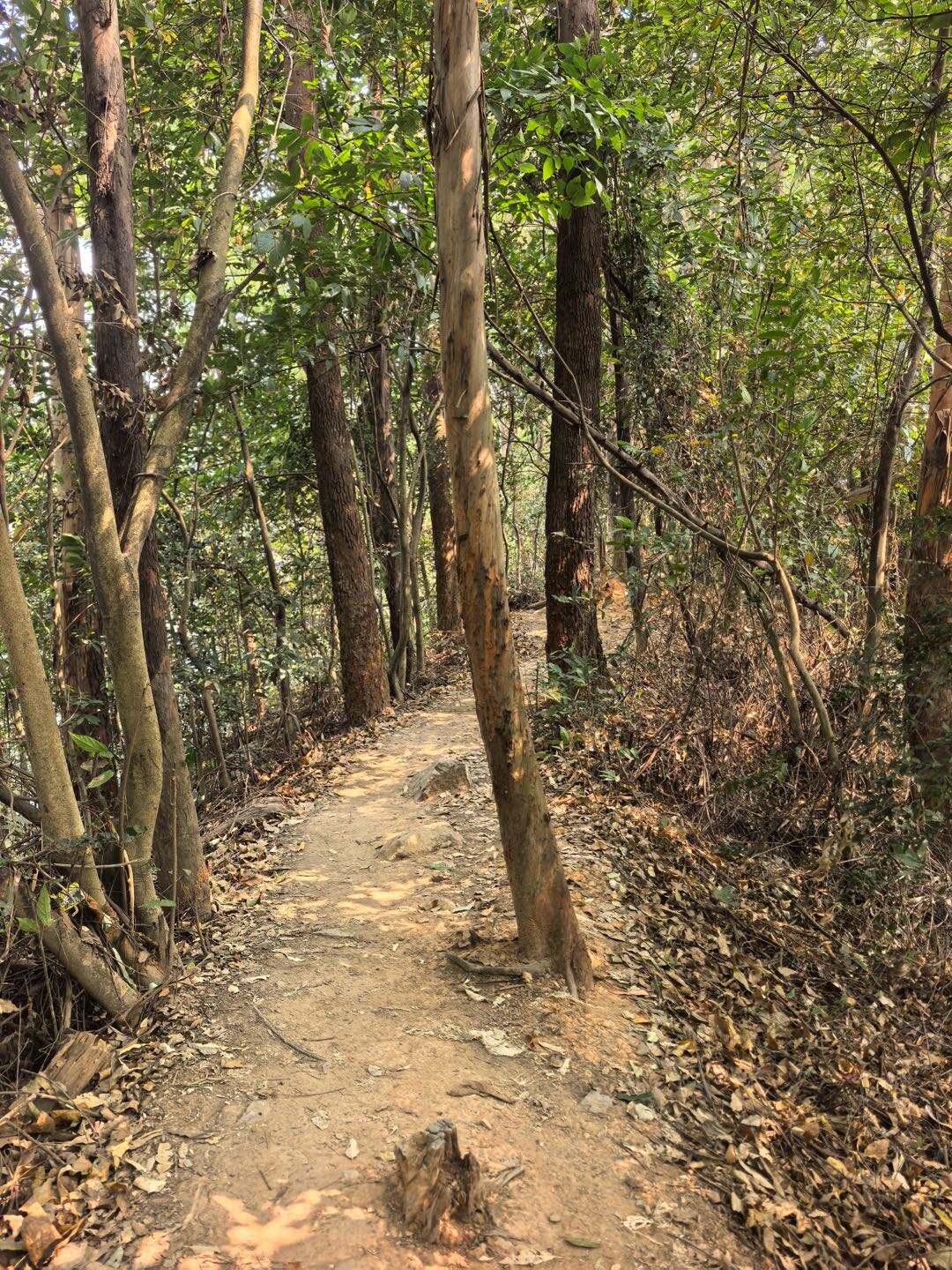
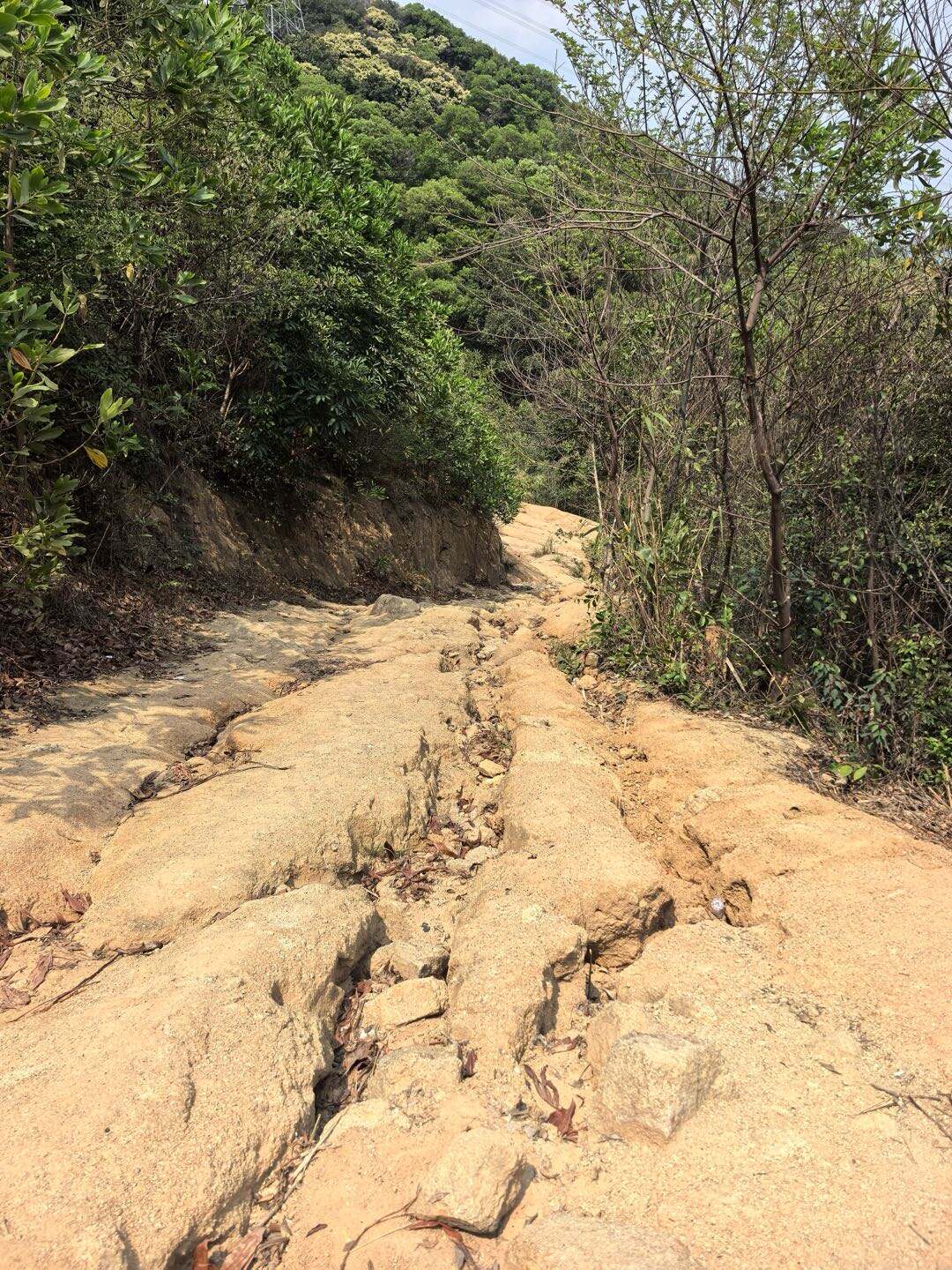
• Road conditions: Gentle steps and forest trails, with plenty of shade
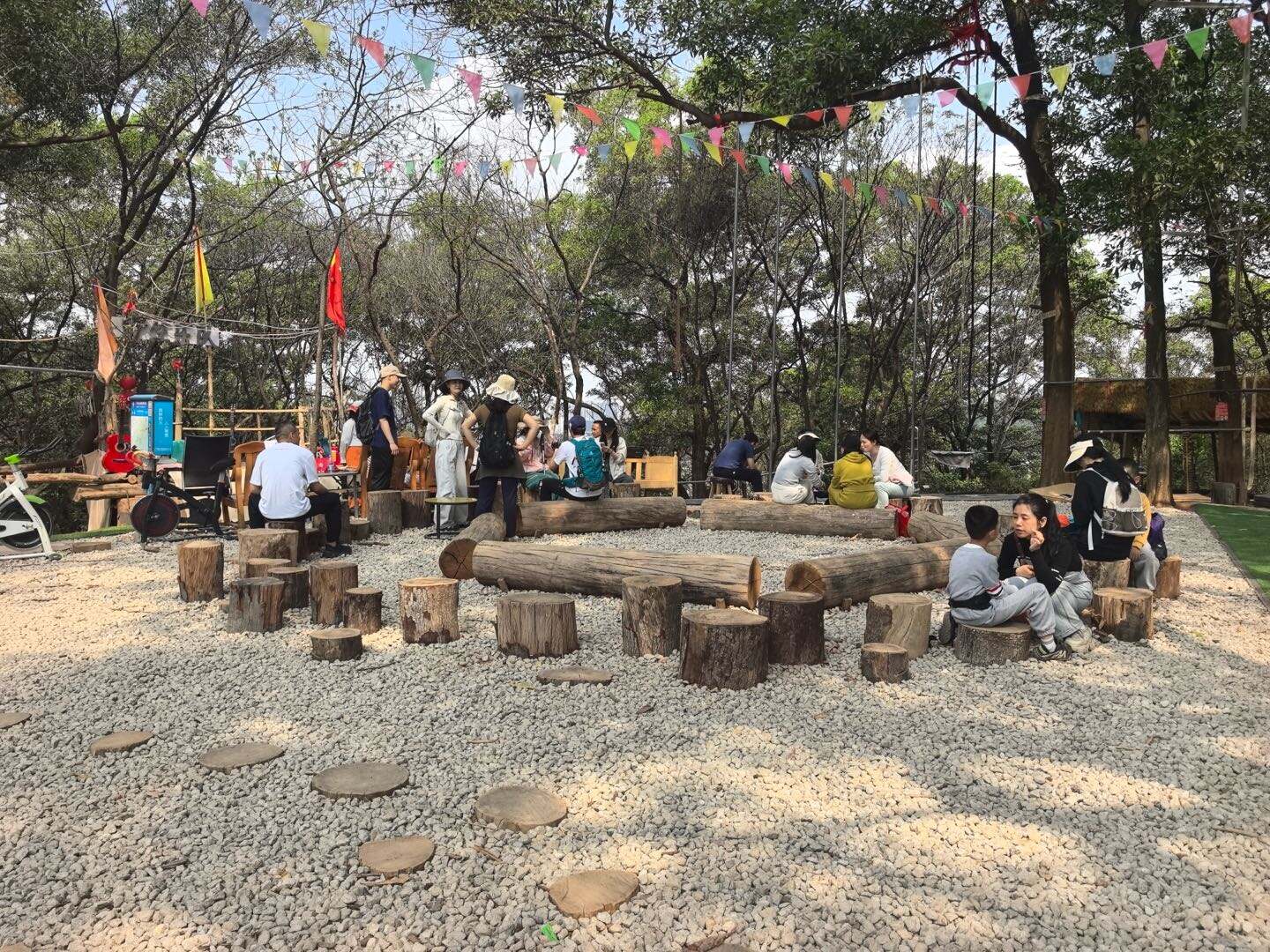
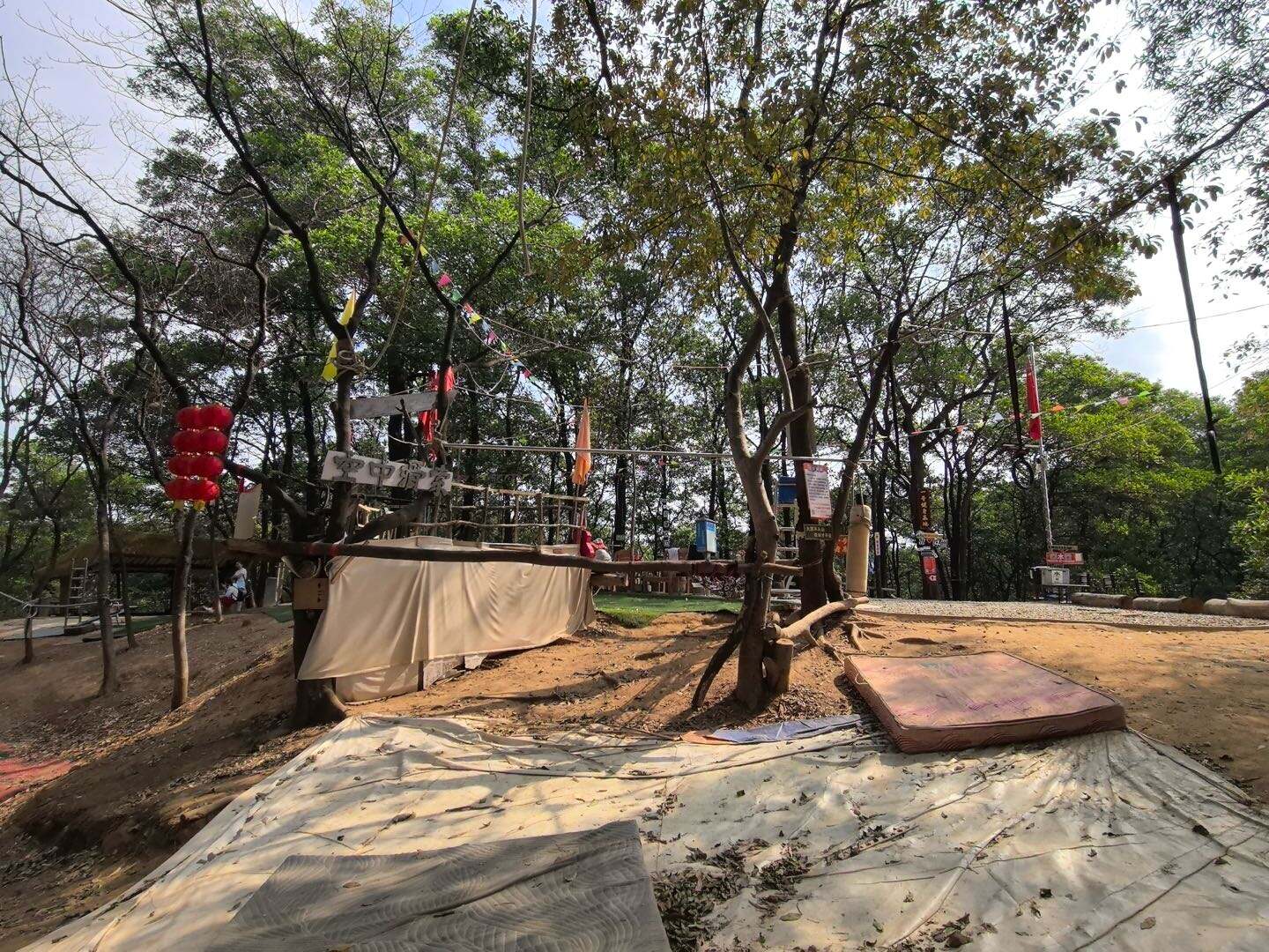
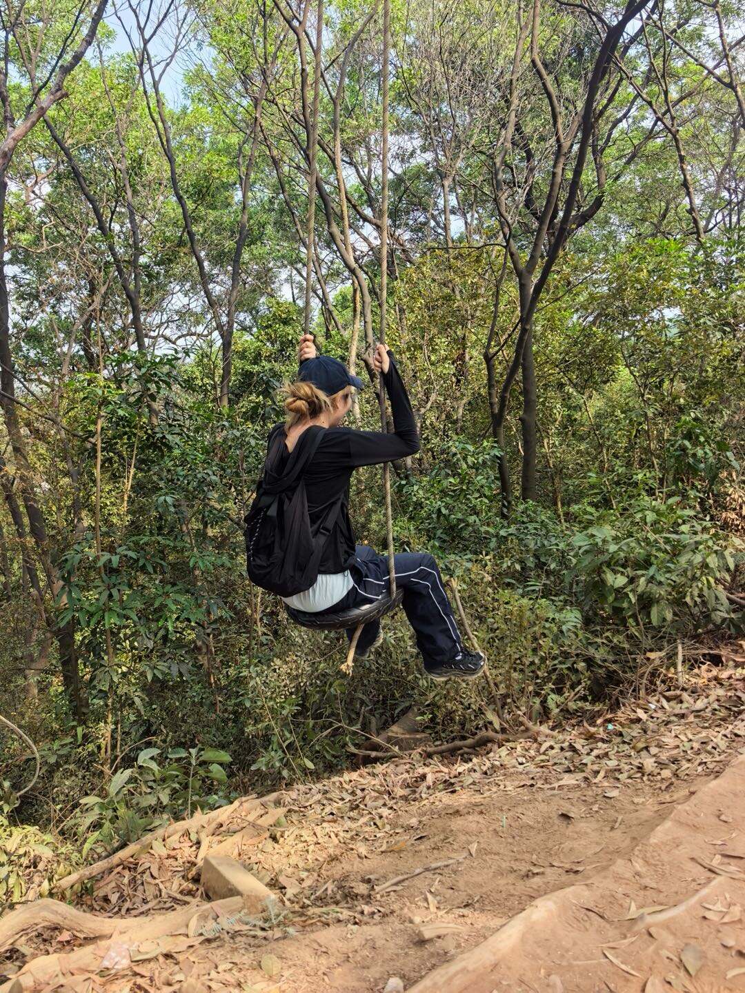
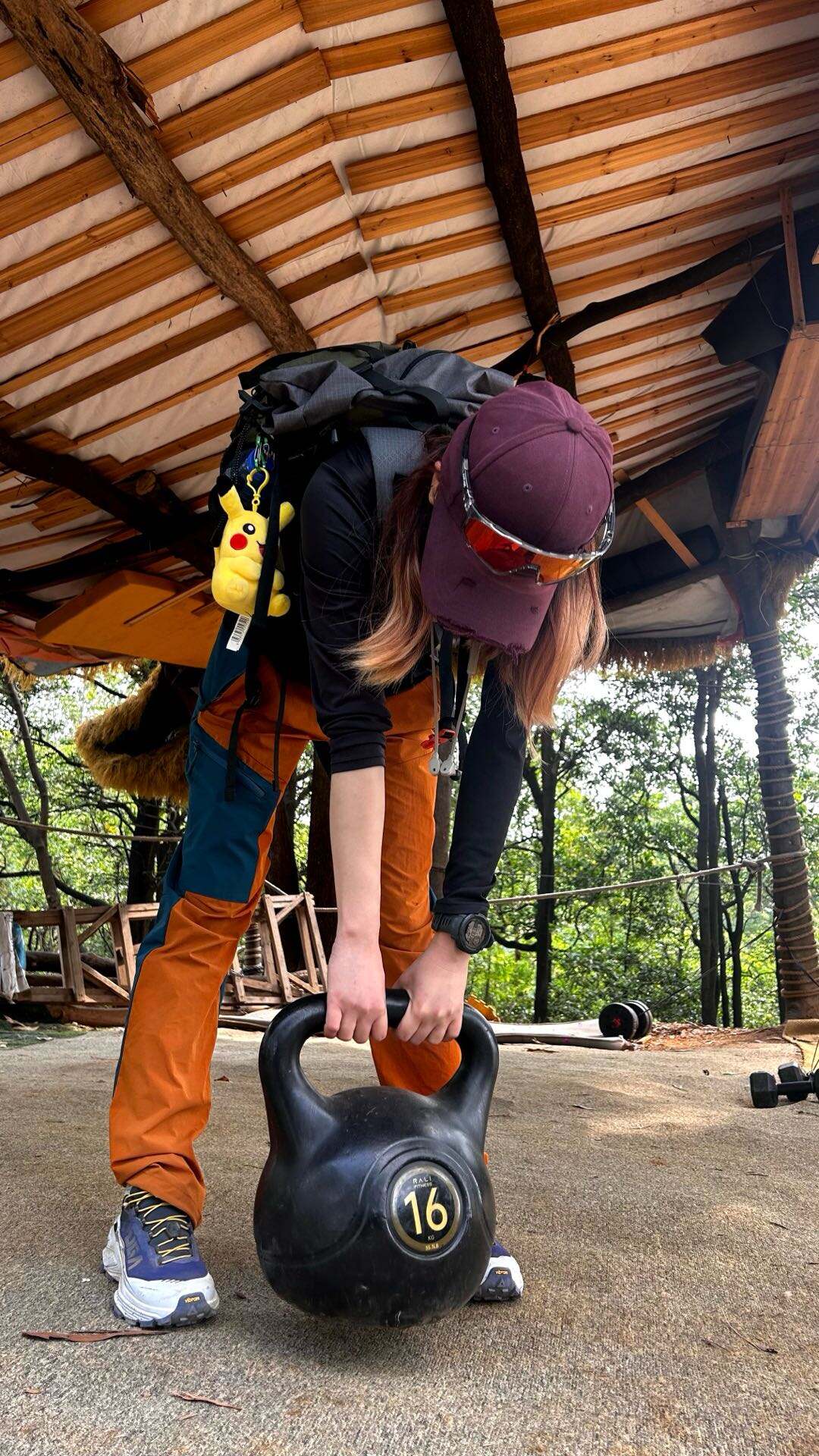
• Scenery: Lush mountain forest, leading to a popular outdoor fitness spot where you can find swings, parallel bars, punching bags, dumbbells and various fitness equipment
• Supply points:
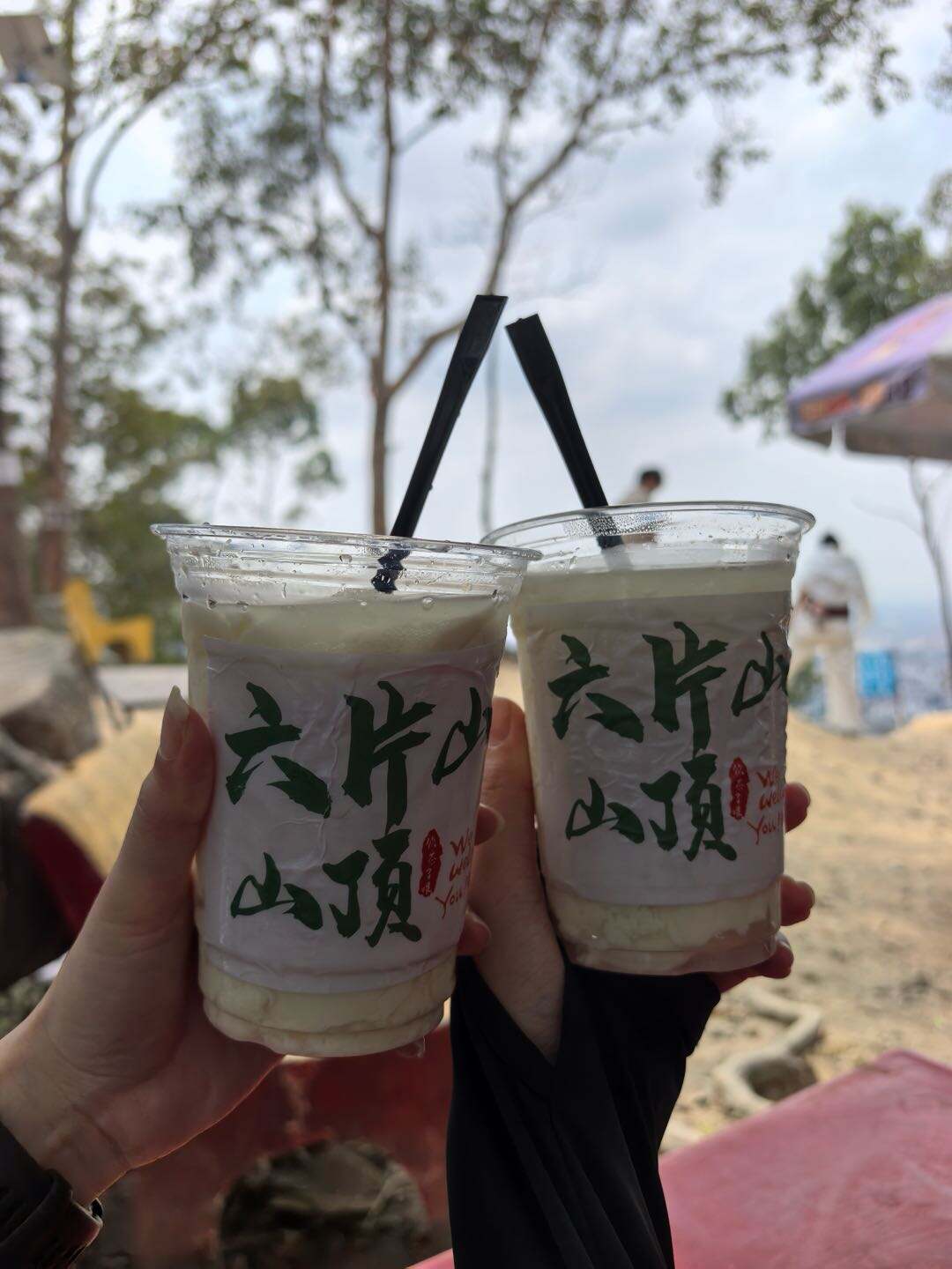
1. Yongtai Station B2: Convenience stores available (water, snacks)
2. No.1 Fitness Base: Water and drinks available
Exit B2, Yongtai Station → No.1 Fitness Base(1km)
• Road conditions: Gentle steps and forest trails, with plenty of shade
• Scenery: Lush mountain forest, leading to a popular outdoor fitness spot where you can find swings, parallel bars, punching bags, dumbbells and various fitness equipment
• Supply points:
1. Yongtai Station B2: Convenience stores available (water, snacks)
2. No.1 Fitness Base: Water and drinks available
2
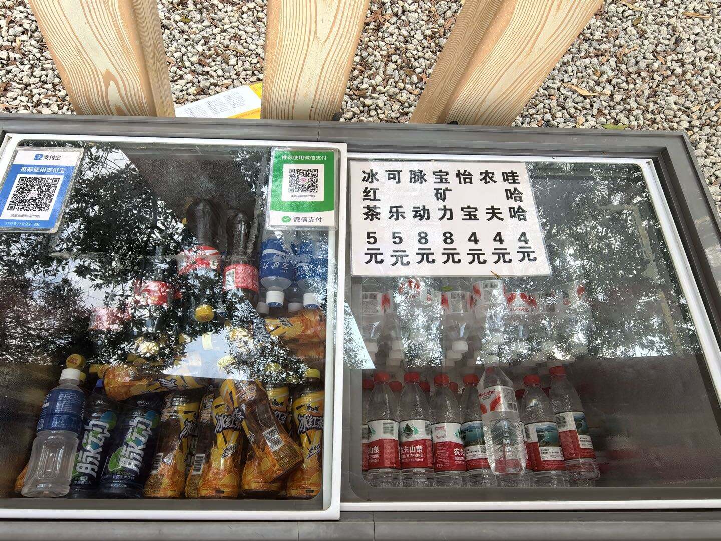
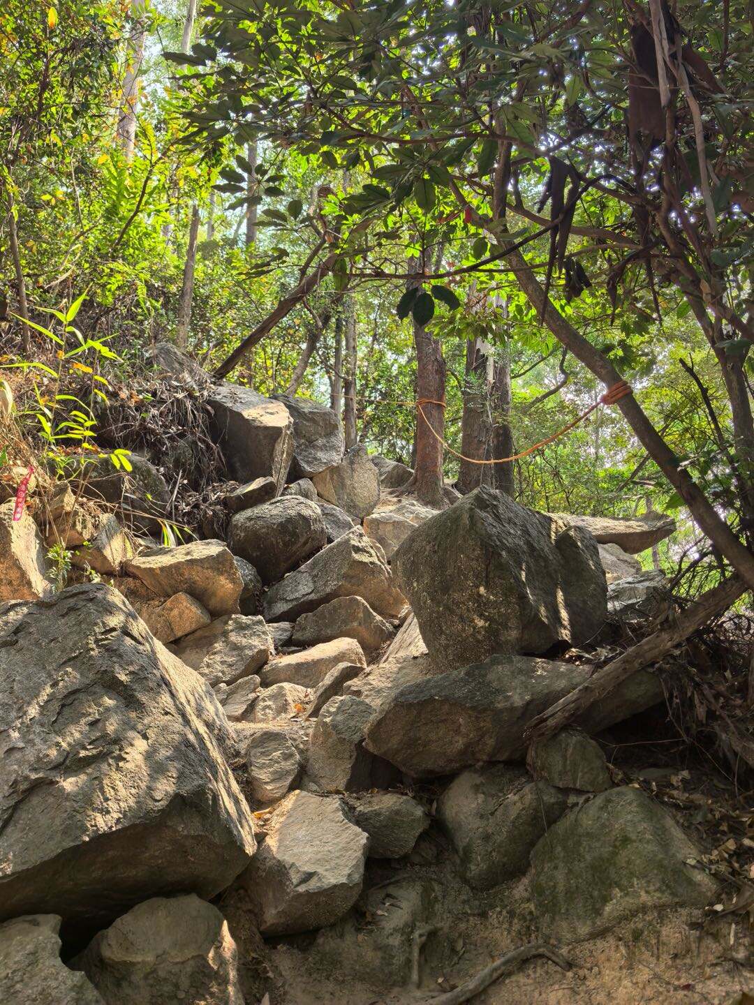
Stage 2: No.1 Fitness Base → Honglu Reservoir(6km)• Road conditions: Short uphill sections, some sections have ropes you can use for assistance, overa
2h 30minStage 2:
No.1 Fitness Base → Honglu Reservoir(6km)
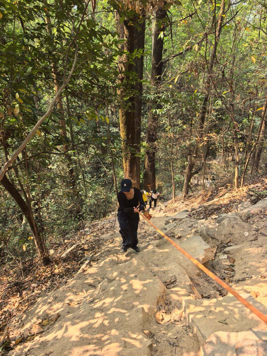
• Road conditions: Short uphill sections, some sections have ropes you can use for assistance, overall easy
• Scenery: Natural mountain and city views and open reservoir scenery
• Supply points: Only 2 supply points selling mineral water and drinks only at a slightly higher price
No.1 Fitness Base → Honglu Reservoir(6km)
• Road conditions: Short uphill sections, some sections have ropes you can use for assistance, overall easy
• Scenery: Natural mountain and city views and open reservoir scenery
• Supply points: Only 2 supply points selling mineral water and drinks only at a slightly higher price

3
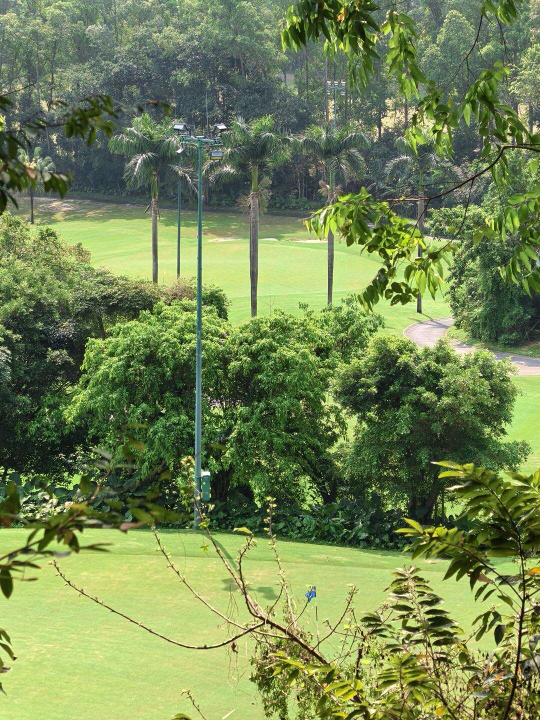
Stage 3: Honglu Reservoir → Tianchi Viewing Platform (Blue Tears) (1km)• Road conditions: Easy hiking trails with gentle slopes• Scenery: The iconic
20 minStage 3:
Honglu Reservoir → Tianchi Viewing Platform (Blue Tears) (1km)
• Road conditions: Easy hiking trails with gentle slopes
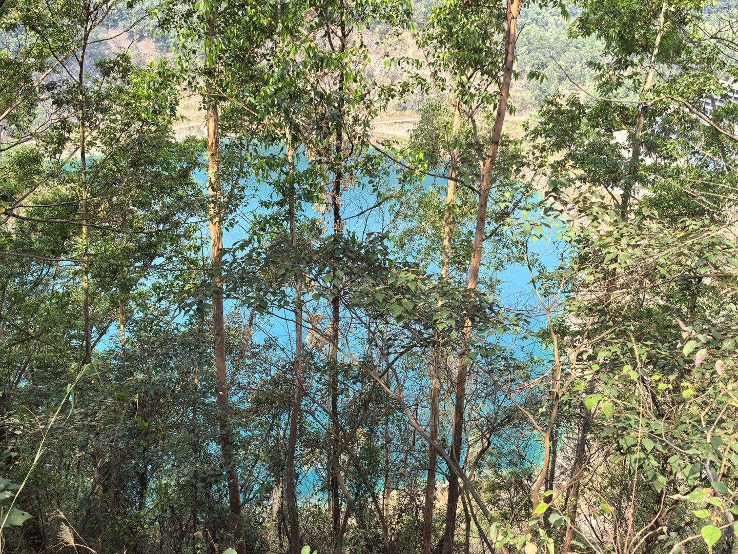
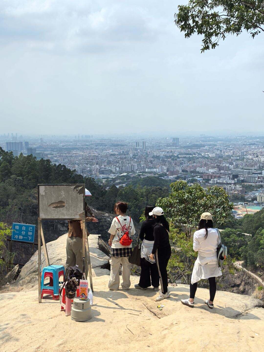
• Scenery: The iconic emerald-green Tianchi Lake, known as “Blue Tears”
• Supply points: Small stall near the viewpoint selling water, snacks and fruits
Honglu Reservoir → Tianchi Viewing Platform (Blue Tears) (1km)
• Road conditions: Easy hiking trails with gentle slopes
• Scenery: The iconic emerald-green Tianchi Lake, known as “Blue Tears”
• Supply points: Small stall near the viewpoint selling water, snacks and fruits

4
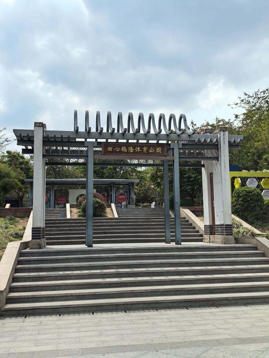
Stage 4: Tianchi Viewing Platform → Tianxin Elong Sports Park(1km)• Road conditions: Gentle downhill trails• Scenery: Mountain and city views, ending
20 minStage 4:
Tianchi Viewing Platform → Tianxin Elong Sports Park(1km)
• Road conditions: Gentle downhill trails
• Scenery: Mountain and city views, ending at the sports park
Tianchi Viewing Platform → Tianxin Elong Sports Park(1km)
• Road conditions: Gentle downhill trails
• Scenery: Mountain and city views, ending at the sports park
Product Options
Standard product
This Liupian Mountain hiking route is about 9–10 kilometers long and normally takes 4–5 hours to complete. It is an entry-level hiking trail within Guangzhou city, mainly consisting of forest paths and stone steps with dense shade and little sun exposure. Along the way, you will pass a wild fitness area, mountain forests, and reservoirs, and finally reaching the summit viewing rock, where you can overlook the popular Tianchi lake “Blue Tears”. The trail offers great scenery, low difficulty, and is perfect for beginners and casual hiking.
Route Overview
Exit B2, Yongtai Station, Metro Line 3→ No.1 Fitness Base → Honglu Reservoir → Tianchi Viewing Platform (Blue Tears) → Tianxin Elong Sports Park
Total distance: About 9 km
Total time: 4–5 hours
Difficulty: Entry-level
Route Overview
Exit B2, Yongtai Station, Metro Line 3→ No.1 Fitness Base → Honglu Reservoir → Tianchi Viewing Platform (Blue Tears) → Tianxin Elong Sports Park
Total distance: About 9 km
Total time: 4–5 hours
Difficulty: Entry-level
From
10.00 USD
per personDuration: 5h
More Details
Reviews (0)
View All →No reviews yet
Be the first to share your experience!
From
USD 10.00
per person